Big-Rig Friendly Stops Along I-80 (Transcontinental)
- How to read the Big-Rig Score
- 9–10 Rolls right in
- 7–8.5 Comfortable
- 5–6.5 Workable, plan ahead
- 3–4.5 Tight
- 1–2.5 Not recommended
By Calvin Whitlock · Last updated June 11, 2026 · How we score
TL;DR: Interstate 80 is the classic transcontinental RV run — Sacramento to the East across CA, NV, UT, WY, NE, IA, and IL. Sequenced west-to-east, these 13 stops score highest on the Big-Rig Standard™, a uniform 1–10 score built from eight data points. Kearney RV Park (9.0) and Camp A Way in Lincoln (9.0) are the easiest Nebraska overnights; SacWest (9.0) is the western anchor with 90-ft pull-throughs; AB Camping in Cheyenne (8.5) and Salt Lake City KOA (8.5) anchor the mountain segment. The one honest lower pick is Truckee River RV Park (6.0) — back-in only and capped at 40 ft, but it's the realistic Sierra stop, so plan around it.
Every stop below is scored the same way, on the same eight data points, so a 9 here means the same thing as a 9 on I-10 or US-50. What decides the score on a long-haul route is whether you can get in tired, sleep, fuel, and get back out without backing 50 feet in the dark — pull-throughs, length capacity, and fuel access carry the most weight. For what each data point means and how the score is calculated, see Big-Rig Friendly, Defined.
How to read the score: 9.0–10 = rolls right in · 7.0–8.5 = big-rig comfortable · 5.0–6.5 = workable with planning · 3.0–4.5 = tight · 1.0–2.5 = not recommended. Cells marked (inferred) are derived from corridor and terrain data, not published specs — confirm with the stop and help us sharpen them via the correction link at the bottom.
The 13 big-rig stops along I-80, west to east
The list runs in driving order from West Sacramento eastward. Scores are noted in each heading; for a strict best-to-worst ranking, Kearney, Camp A Way, and SacWest tie at the top (9.0).
1. SacWest RV Park & Campground — West Sacramento, CA

The western anchor and the easiest first or last night on the whole route. SacWest runs 90-foot pull-throughs with 50-amp full hookups, a half-mile off I-80 at the Enterprise Blvd exit on the West Sacramento side — flat valley floor, no grade, services everywhere. This is the "stage here before you climb the Sierra" pick: top off, sleep level, and hit Donner Pass rested.
| Data point | Value |
|---|---|
| Max rig length | Up to 90 ft (pull-through, rig + toad) |
| Turn radius / entry | Wide valley-floor layout; easy off the Enterprise Blvd exit (inferred — adequate) |
| Pull-through vs. back-in | Pull-through (90 ft) and back-in |
| Low-clearance warnings | None (inferred — open valley layout) |
| Fuel within 10 mi | Diesel + propane — I-80 West Sacramento corridor (inferred — strong) |
| Grade on approach | None — Sacramento valley floor |
| Overnight allowed | Yes |
| Surface / power | Paved/gravel pads · 30/50-amp full hookups |
3951 Lake Rd, West Sacramento, CA 95691 · (916) 371-6771 (verified Jun 2026)
2. Truckee River RV Park — Truckee, CA

The honest one on this route. Truckee River RV Park sits right off I-80 at the Hirschdale exit, six miles east of historic Truckee at roughly 5,900 ft — and it's back-in only, capped at 40 feet, with no pull-throughs. For a 45-foot Class A it's a hard pass; for a 40-footer it's a workable Sierra stop with a real upside: an on-site gas station and propane, so you can fuel before the long descent. Score it for the convenience and the location, not the maneuvering. Call ahead and ask for an end site.
| Data point | Value |
|---|---|
| Max rig length | Up to 40 ft (Class A); tight for 45 ft+ |
| Turn radius / entry | Mountain park; back-in maneuvering required; confirm site on arrival |
| Pull-through vs. back-in | Back-in only — no pull-throughs |
| Low-clearance warnings | Sierra tree canopy possible on interior — confirm your roofline (inferred — caution) |
| Fuel within 10 mi | Diesel + propane on-site (general store / gas station) (verified Jun 2026) |
| Grade on approach | Sierra corridor — Donner Pass grades nearby; descend in low gear (inferred — caution) |
| Overnight allowed | Yes |
| Surface / power | Full hookups (water/sewer/electric); confirm 50-amp on site (inferred) |
10068 Hirschdale Rd, Truckee, CA 96161 · (530) 606-5020 · I-80 Hirschdale exit · back-in only, 40 ft max — plan around it
3. Silver State RV Park — Winnemucca, NV

The reliable Nevada high-desert overnight, right off I-80 in Winnemucca with 139 sites and dedicated pull-through rows (sites 61–136 and 149–151), 30/50-amp service, water and sewer, and an on-site propane refill. Pads are level gravel, which is the only thing keeping it out of the 9s — gravel plus desert wind beats a tight concrete park for a big rig any day. Easy in, easy out, fuel at the exit.
| Data point | Value |
|---|---|
| Max rig length | 45 ft+ (inferred — dedicated big-rig pull-through rows) |
| Turn radius / entry | Open high-desert layout; designated pull-through loops |
| Pull-through vs. back-in | Pull-through (sites 61–136, 149–151) and back-in |
| Low-clearance warnings | None (inferred — open desert layout) |
| Fuel within 10 mi | Diesel + propane (on-site propane refill) — I-80 Winnemucca (inferred — strong; propane on-site verified Jun 2026) |
| Grade on approach | None — valley floor at the Winnemucca exits |
| Overnight allowed | Yes |
| Surface / power | Level gravel pads · 30/50-amp full hookups |
5575 E Winnemucca Blvd, Winnemucca, NV 89445 · (775) 623-4513 · off I-80 in Winnemucca · on-site propane
4. Wendover KOA Journey + Bonneville Salt Flats — West Wendover, NV

The scenic stop with a big-rig basecamp. The Bonneville Salt Flats sit just east of the NV/UT line at I-80 Exit 4, with a state rest area and a hard-packed viewing access where you can walk (or, off-season and outside permitted events, drive) onto the salt — no overnight on the flats, and no shade, so it's a daytime stop. Stage at the Wendover KOA Journey, 10 miles west, which runs 80-foot pull-throughs with 50-amp full hookups and room for a toad. Score reflects the basecamp; the flats themselves are a park-and-walk, not a campsite.
| Data point | Value |
|---|---|
| Max rig length | Up to 80 ft (KOA pull-through, rig + toad) |
| Turn radius / entry | KOA: open desert layout, big-rig pull-through loops. Salt Flats: large flat rest-area lot off Exit 4 |
| Pull-through vs. back-in | Pull-through (80 ft) and back-in at the KOA |
| Low-clearance warnings | None — open salt-desert basin |
| Fuel within 10 mi | Diesel + propane — Wendover / West Wendover I-80 exits (inferred — strong) |
| Grade on approach | None — Great Salt Lake Desert is dead flat |
| Overnight allowed | KOA yes (reservation); Salt Flats no overnight / no camping on the salt |
| Surface / power | KOA: 30/50-amp full hookups. Salt Flats: hard-packed salt — do not drive onto wet/soft salt (inferred — caution) |
651 Camper Dr, West Wendover, NV 89883 · (800) 562-8552 (verified Jun 2026)
5. Salt Lake City KOA Holiday — Salt Lake City, UT

The metro anchor for the Wasatch crossing. The Salt Lake City KOA runs 80-foot pull-through patio sites with 50/30-amp full hookups, a few minutes off I-80 near the airport on North Temple — the rare big-city park where a 45-footer plus toad gets a level pull-through and you're still 14 blocks from downtown. Read the KOA directions carefully (the airport interchange has a couple of turns) and you'll roll right in.
| Data point | Value |
|---|---|
| Max rig length | Up to 45 ft comfortably (80 ft pull-through pad with toad) |
| Turn radius / entry | Established KOA loops; follow posted KOA routing off the airport exit (inferred — adequate with directions) |
| Pull-through vs. back-in | Pull-through (80 ft patio sites) and back-in |
| Low-clearance warnings | None at the park (inferred); mind posted clearances on the airport-area approach (inferred — caution) |
| Fuel within 10 mi | Diesel + propane — I-80 / SLC airport corridor (inferred — strong) |
| Grade on approach | None at the park — valley floor (Wasatch grades are on the route east, not at the site) |
| Overnight allowed | Yes (reservation) |
| Surface / power | Paved/gravel patio pads · 30/50-amp full hookups |
1400 W North Temple St, Salt Lake City, UT 84116 · (801) 328-0224 (verified Jun 2026)
6. AB Camping & RV Park — Cheyenne, WY

The crossroads stop where I-80 meets I-25 — and a Good Sam park built for rigs. AB Camping runs 82 full-hookup pull-through sites (50/30-amp) that accommodate rigs up to 60 feet, shaded by cottonwoods, with an on-site BBQ restaurant. From the I-80/I-25 junction it's a half-mile south on I-25 to College Drive (Exit 7), then a mile and a half east. High plains at 6,000+ ft means wind, not grade — an easy in-and-out either direction.
| Data point | Value |
|---|---|
| Max rig length | Up to 60 ft (pull-through, rig + toad) |
| Turn radius / entry | Established pull-through loops; College Dr (I-25 Exit 7) approach (inferred — adequate) |
| Pull-through vs. back-in | Pull-through (82 sites) plus electric-only pads |
| Low-clearance warnings | None (inferred — open high-plains layout) |
| Fuel within 10 mi | Diesel + propane — I-80 / I-25 Cheyenne junction (inferred — strong) |
| Grade on approach | None at the site; high-plains crosswinds common (inferred — caution) |
| Overnight allowed | Yes |
| Surface / power | Full hookups · 50/30-amp |
1503 W College Dr, Cheyenne, WY 82007 · (307) 634-7035 (verified Jun 2026)
7. Sapp Bros Travel Center — Elm Creek / Odessa, NE

The honest fuel-and-sleep stop, not a resort. This Sapp Bros at I-80 Exit 263 is a 24-hour travel center with diesel, RV gasoline, propane bottles, and ~65 free parking spaces — the kind of stop you take when you're making miles and want fuel, a shower, and a few hours of level pavement rather than hookups. No full-hookup RV sites, so it scores as a workable overnight, not a destination. Park well clear of the truck fuel lanes and you're set.
| Data point | Value |
|---|---|
| Max rig length | 45 ft+ (large paved truck-stop lot) |
| Turn radius / entry | Wide travel-center lot; truck-scale layout, easy big-rig swing |
| Pull-through vs. back-in | Pull-in / drive-through truck-stop parking (no marked RV pads) |
| Low-clearance warnings | Mind fuel-canopy height over the diesel lanes — stay in the high-clearance/RV-gas lanes (inferred — caution) |
| Fuel within 10 mi | Diesel + propane on-site (24-hr) (verified Jun 2026) |
| Grade on approach | None — flat Platte Valley |
| Overnight allowed | Yes — free overnight truck/RV parking (no hookups) |
| Surface / power | Paved lotno hookups (generator/boondock) |
380 Odessa Rd, Elm Creek, NE 68836 · (308) 234-1662 · I-80 Exit 263 · 24-hr fuel + free overnight parking, no hookups
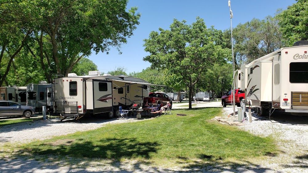
8. Kearney RV Park & Campground — Kearney, NE

The model interstate overnight, and one of the easiest stops on the whole corridor. 76 large concrete pull-through sites, all full hookup with 50-amp, right off I-80 at Exit 272 (or 275) in the dead-flat Platte Valley — the operator's own pitch is "easy to get in, go to sleep, wake up and head out," and the specs back it. Concrete pads (not gravel), no grade, fuel at the exit. If you want one guaranteed-easy Nebraska night, this is it.
| Data point | Value |
|---|---|
| Max rig length | 45 ft+ (large concrete pull-throughs) |
| Turn radius / entry | Wide concrete pull-through loops; easy off Exit 272/275 |
| Pull-through vs. back-in | All 76 sites pull-through (concrete) |
| Low-clearance warnings | None (inferred — open layout) |
| Fuel within 10 mi | Diesel + propane — I-80 Exit 272/275 Kearney (inferred — strong) |
| Grade on approach | None — flat Platte Valley |
| Overnight allowed | Yes — ideal one-night stop |
| Surface / power | Concrete50-amp full hookups |
1140 E 1st St, Kearney, NE 68847 · (308) 237-7275 (verified Jun 2026)
9. Camp A Way RV Park — Lincoln, NE
The eastern-Nebraska overnight, just off I-80 at the Lincoln exits. Camp A Way runs pull-through sites in the 65–95 ft range (pull-throughs up to ~75 ft of usable pad) with 50-amp full hookups on the larger sites — long enough for a 45-footer and a toad without unhitching. Flat, easy, well-reviewed for big rigs, and close enough to the interstate to be a true drive-in/drive-out stop. Request a 50-amp pull-through when you book.
| Data point | Value |
|---|---|
| Max rig length | Up to ~75 ft pad (rig + toad); 45-footer fits easily |
| Turn radius / entry | Pull-through layout; easy off the Lincoln I-80 exit (inferred — adequate) |
| Pull-through vs. back-in | Pull-through (65–95 ft sites) — request 50-amp pull-through |
| Low-clearance warnings | None (inferred — open layout) |
| Fuel within 10 mi | Diesel + propane — I-80 Lincoln corridor (inferred — strong) |
| Grade on approach | None — flat |
| Overnight allowed | Yes — strong one-night stop |
| Surface / power | Full hookups · 20/30/50-amp (50-amp on larger pull-throughs) |
200 Campers Cir, Lincoln, NE 68521 · (402) 476-2282 (verified Jun 2026)
10. Kellogg RV Park — Kellogg, IA

The independent Iowa find, halfway between Des Moines and the Quad Cities. 38 level pull-through sites with 20/30/50-amp, a short hop north on Hwy 224 from I-80 Exit 173 — and the on-site Iowa's Best Burger Cafe is a genuine reason to stop, not just refuel. Not every site is full-hookup (15 are), so ask for a 50-amp full-hookup pull-through when you call. Easy, flat, friendly, and not a chain.
| Data point | Value |
|---|---|
| Max rig length | 45 ft+ (inferred — level pull-throughs) |
| Turn radius / entry | Open rural layout; brief Hwy 224 jog north off Exit 173 |
| Pull-through vs. back-in | All 38 pull-through (15 full-hookup; confirm on booking) |
| Low-clearance warnings | None (inferred — open layout) |
| Fuel within 10 mi | Diesel + propane — I-80 Exit 173 / Newton corridor (inferred) |
| Grade on approach | None — flat central Iowa |
| Overnight allowed | Yes |
| Surface / power | Level pads · 20/30/50-amp (full hookups on 15 sites) |
1570 IA-224, Kellogg, IA 50135 · (641) 526-8535 (verified Jun 2026)
11. Interstate RV Park — Davenport, IA

The Quad Cities approach stop, just north of I-80 off Northwest Blvd in Davenport. Pull-through sites and full hookups for rigs up to 75 feet with 50-amp service — plenty for a 45-footer plus toad — and an easy in/out a short distance off the interstate. A solid, no-drama eastern-Iowa overnight before you cross the Mississippi into Illinois.
| Data point | Value |
|---|---|
| Max rig length | Up to 75 ft (pull-through, rig + toad) |
| Turn radius / entry | North of I-80 off Northwest Blvd; established layout (inferred — adequate) |
| Pull-through vs. back-in | Pull-through (up to 75 ft) and back-in |
| Low-clearance warnings | None (inferred — open layout) |
| Fuel within 10 mi | Diesel + propane — I-80 Davenport / Northwest Blvd (inferred — strong) |
| Grade on approach | None — flat |
| Overnight allowed | Yes |
| Surface / power | Full hookups · 20/30/50-amp |
8448 N Fairmount St, Davenport, IA 52806 · (563) 386-7292 (verified Jun 2026)
12. Rock Island / Quad Cities KOA — Rock Island, IL

The first Illinois stop after the Mississippi, on the Rock Island side of the Quad Cities. This KOA accommodates big rigs to 85 feet on pull-throughs with 50/30-amp full hookups, on 150+ acres with a 50-acre lake — generous spacing and easy maneuvering, with on-site RV repair if the crossing rattled something loose. Reached via I-280 (Exit 11A) off the I-80 corridor; year-round.
| Data point | Value |
|---|---|
| Max rig length | Up to 85 ft (pull-through, rig + toad) |
| Turn radius / entry | 150+ acres — generous spacing and turn radius |
| Pull-through vs. back-in | Pull-through (up to 85 ft) and back-in |
| Low-clearance warnings | None (inferred — open acreage) |
| Fuel within 10 mi | Diesel + propane — Quad Cities I-80 / I-280 corridor (inferred — strong) |
| Grade on approach | None — flat river valley |
| Overnight allowed | Yes (open year-round) |
| Surface / power | Full hookups · 30/50-amp; on-site RV repair |
2311 78th Ave W, Rock Island, IL 61201 · (309) 787-0665 (verified Jun 2026)
13. Hickory Grove Camp — Sheffield (Hennepin Canal), IL

The quieter Illinois option as I-80 heads on toward Chicago. Hickory Grove runs 30/50-amp full-hookup pull-throughs for large rigs up to 80 feet, just two miles north of I-80, sitting on the Hennepin Canal trail for hiking, fishing, and paddling. Knock half a point off SacWest-class scores for the two-mile county-road jog off the interstate and a bathhouse that opens May 1 — otherwise an easy, level, big-rig-capable stop.
| Data point | Value |
|---|---|
| Max rig length | Up to 80 ft (pull-through) |
| Turn radius / entry | Open rural layout; 2 mi north of I-80 on a county road (inferred — confirm last turn) |
| Pull-through vs. back-in | Pull-through (up to 80 ft) and back-in |
| Low-clearance warnings | None (inferred — open layout) |
| Fuel within 10 mi | Diesel + propane — I-80 Sheffield / Princeton corridor (inferred) |
| Grade on approach | None — flat |
| Overnight allowed | Yes (note: bathhouse opens May 1) |
| Surface / power | Full hookups · 30/50-amp |
7478 1745 N Ave, Sheffield, IL 61361 · (815) 454-2600 (verified Jun 2026)
How we scored these
Every stop is scored on the Big-Rig Standard™: a weighted 1–10 composite. For campground stops we weight length capacity (30%), site type & power (20%), maneuverability (20%), clearance & grade (15%), fuel & services within 10 mi (10%), and stay flexibility (5%). For non-campground stops — the Bonneville Salt Flats scenic stop and the Sapp Bros fuel stop — we shift the weight to what actually matters there: access & maneuverability, low clearance, overnight rules, and fuel proximity, and we say plainly that they aren't full-hookup destinations.
On a transcontinental run, the factors that move the score are pull-through availability and length capacity (you want drive-in/drive-out when you arrive tired), then fuel access and clearance. That's why a flat, concrete, all-pull-through park like Kearney (9.0) outscores a beautiful but back-in, 40-foot-capped mountain stop like Truckee River (6.0) — they're measured against the same eight data points, not against the scenery. I-80's real terrain challenge is grade on the mountain segments (Donner Pass in the Sierra, the Wasatch east of Salt Lake, the climb over the Laramie Range in Wyoming); we keep grade and clearance fields conservative and flag rather than reassure.
Site dimensions, pull-through counts, amp service, and surface are sourced from each stop's listing (June 2026), and exit positions were checked against I-80 mile markers. Fuel proximity, clearance, and grade are inferred from the corridor's road network and terrain and marked (inferred) in each table — except where we directly confirmed fuel on-site (Truckee River, Silver State propane, Sapp Bros), which is marked (verified Jun 2026).
How this list was made: We screened RV parks, travel centers, and scenic stops along the full I-80 corridor for published big-rig specs (pull-through length, 50-amp full hookups, lot capacity), sequenced them west-to-east by exit/mile marker, scored each on the Big-Rig Standard™, and cross-checked maneuvering notes against guest reviews on Campendium, The Dyrt, RV LIFE, and Good Sam. Research and drafting were AI-assisted and human-reviewed. We have not personally driven into every stop on this list — where a score rests on inference rather than a published spec or a guest report, the cell is marked (inferred), and safety-relevant fields (clearance, grade) are kept conservative. No business paid for placement or for its score.
Sources
- Park / travel-center specifications: official listings for SacWest RV Park, Truckee River RV Park, Silver State RV Park, Wendover KOA Journey, Salt Lake City KOA Holiday, AB Camping & RV Park (Open Road Resorts), Sapp Bros Travel Center (Elm Creek/Odessa), Kearney RV Park & Campground, Camp A Way, Kellogg RV Park, Interstate RV Park (Davenport), Rock Island / Quad Cities KOA, and Hickory Grove Camp (accessed June 2026).
- Scenic stop: Bonneville Salt Flats Special Recreation Management Area (BLM) and Utah/Nevada I-80 rest-area information (accessed June 2026).
- Maneuvering / spacing notes: guest reviews on Campendium, The Dyrt, RV LIFE, and Good Sam (accessed June 2026).
- Exit positions checked against I-80 mile-marker references (accessed June 2026).
Verification status (last verified June 11, 2026): Name, address, and phone confirmed via web for all stops except AB Camping & RV Park, whose listing redirected to a rebranded park page (Cheyenne Sky RV Park) at the same 1503 W College Dr address — phone is held as pending direct confirmation. Fuel access was directly verified on-site for Truckee River (gas + propane), Silver State (propane refill), and Sapp Bros (24-hr diesel + propane); for the other corridor stops, diesel + propane within 10 mi is high-confidence from the I-80 fuel network but not individually walked — those cells remain marked (inferred). Per-listing GPS coordinates and low-clearance/Street-View checks (especially the Sierra and Wasatch grade segments) are pending and will be confirmed during the directory build.
Frequently asked questions
What are the best big-rig RV stops along I-80?
For drive-in/drive-out ease, the top picks are Kearney RV Park (9.0) and Camp A Way in Lincoln (9.0) in Nebraska, and SacWest (9.0) in West Sacramento — all flat, all pull-through, all 50-amp, all right off the interstate. AB Camping in Cheyenne (8.5), Salt Lake City KOA (8.5), and the Rock Island / Quad Cities KOA (8.5) anchor the mountain and eastern segments.
Can a 45-foot motorhome drive the whole I-80 corridor?
Yes. Most stops on this list take 45 feet plus a toad on pull-throughs (SacWest at 90 ft, Rock Island KOA at 85 ft, Salt Lake City KOA and Hickory Grove at 80 ft). The one to plan around is Truckee River RV Park (6.0), which is back-in only and capped at 40 feet — if you're at 45 ft, stage at SacWest before the Sierra instead.
Where can I stop for fuel and a quick overnight on I-80 in Nebraska?
The Sapp Bros Travel Center at I-80 Exit 263 (6.5) near Elm Creek/Odessa has 24-hour diesel, RV gasoline, propane bottles, and free overnight parking — no hookups, but ideal when you're making miles. For a full-hookup night nearby, Kearney RV Park (9.0) is one exit cluster east at Exit 272.
Is the Bonneville Salt Flats stop doable in a big rig?
As a daytime scenic stop, yes — the Salt Flats access is off I-80 Exit 4 with a large flat rest-area lot, but there's no overnight and no camping on the salt, and you should never drive a rig onto wet or soft salt. Stage 10 miles west at the Wendover KOA Journey (7.5), which has 80-foot big-rig pull-throughs with full hookups.
Which parts of I-80 have grades a big rig should plan for?
Three segments: Donner Pass in the California Sierra (descend in low gear toward Sacramento), the Wasatch east of Salt Lake City, and the climb over the Laramie Range in southern Wyoming. None of the listed stops sit on a steep grade, but the driving between them does — we keep grade and clearance fields conservative for that reason.
Are chains required on I-80 over Donner Summit?
During winter storms, yes — Caltrans posts chain controls on I-80 over Donner Pass, and big rigs are often required to carry and fit chains regardless of drive type. Conditions change hour to hour, so check Caltrans QuickMap before you climb. If chains are up and you'd rather not fit them on a 45-footer, stage at SacWest (9.0) on the valley floor and wait it out.
What's the speed limit on I-80 in Wyoming?
Wyoming posts 80 mph on long stretches of rural I-80, but that's a car number — a loaded big rig has no business running it across that high-plains corridor. Crosswinds, grades over the Laramie Range, and sudden weather are the real governors. Drive the conditions, not the sign, and slow well down when the wind picks up.
What's the biggest road hazard for a big rig on I-80 in Wyoming?
Wind. The high-plains stretch across southern Wyoming gets sustained crosswinds and gusts strong enough to push a high-profile rig around or trigger blow-over closures for light and high-sided vehicles. Watch posted wind warnings, keep both hands on the wheel through the Laramie Range, and be ready to pull off at a stop like AB Camping in Cheyenne (8.5) if it turns nasty.
Is I-80 from Reno to Sacramento ever closed?
It can be — the Sierra segment over Donner Pass closes during heavy winter storms for avalanche control, spinouts, or whiteout conditions, sometimes for hours. We don't post live status; check Caltrans QuickMap before you commit to the climb. When in doubt, fuel and sleep low at SacWest (9.0) on the Sacramento side and cross rested in daylight.
How do I check I-80 conditions in Wyoming before I drive it?
Use the Wyoming DOT 511 system (wyoroad.info or the 511 app) for live closures, wind warnings, and chain or restriction notices before you roll. I-80 across Wyoming closes more than most interstates because of wind and snow, so check it the morning you drive, not the night before. We don't publish live conditions — plan your fuel and overnight around the official feed.
What does FHU mean for an RV stop?
FHU stands for "full hookups" — water, sewer, and electric all at the site, so you can run everything without your tanks or batteries. On this list, the full-hookup stops let you arrive, plug in, and sleep without dumping or refilling first. Fuel-only stops like the Sapp Bros Travel Center (6.5) have no hookups, so plan a boondock or generator night there.
What's the 3-3-3 rule for RV road trips like I-80?
The 3-3-3 rule is a pacing guideline: drive no more than about 300 miles a day, arrive by 3 p.m., and stay at least 3 nights (or just stop 3 days running). On a long haul like I-80 it keeps you off the road tired and in the dark — which is exactly when backing a 45-footer goes wrong. It's a guideline, not a law; adjust it to your rig and the weather.
Compare across the directory: Big-Rig Friendly Campgrounds in California · Big-Rig Friendly Campgrounds in Oregon · Big-Rig Friendly Restaurants in California (with RV parking) · Big-Rig Friendly Stops Along US-50 (the parallel "Loneliest Road") · What "Big-Rig Friendly" means
[ Submit a correction → ] Driven this stretch of I-80? Tell us what the data got wrong and we'll update the score.
Found a stop we missed — or got wrong?
The standard gets sharper when real RVers push back. Tell us what you saw on the ground and we'll re-check it.