Big-Rig Friendly Stops Along the Blue Ridge Parkway
- How to read the Big-Rig Score
- 9–10 Rolls right in
- 7–8.5 Comfortable
- 5–6.5 Workable, plan ahead
- 3–4.5 Tight
- 1–2.5 Not recommended
By Calvin Whitlock · Last updated June 11, 2026 · How we score
Read this first — clearance caveat: The Blue Ridge Parkway is not a road you drive end-to-end in a 40-foot rig. All 26 tunnels but one sit on the North Carolina end, and the lowest — Big Witch Tunnel (MP 461.2) at 11 ft 7 in and Lickstone Ridge (MP 458.8) at 11 ft 8 in posted edgeline clearance — will not clear most Class A motorhomes (12–13 ft tall). The Park Service warns those numbers can drop another 1–6 inches after repaving. So this isn't a "drive the whole thing" guide. It's a what you CAN do guide: which sections a big rig handles, which overlooks have real RV parking, which tunnels to turn around before, and the Big-Rig Friendly basecamps just off the Parkway near Asheville, Boone, and Cherokee.
TL;DR: The honest plan is to basecamp off the Parkway and day-trip the scenic sections in your toad. Of 13 stops scored on the Big-Rig Standard™, the best big-rig basecamps are Asheville Bear Creek RV Park (9.0) off I-40 and Fancy Gap / Blue Ridge Parkway KOA (8.5) at the Virginia end. Virginia's 217 tunnel-free miles (MP 0–217) are the only stretch you can run a tall rig with confidence. The honest low picks: Mount Pisgah Campground (5.0) and Peaks of Otter (4.0) are NPS no-hookup, length-limited campgrounds — workable only with a short rig and planning — and the Waynesville-to-Cherokee tunnels (1.5) are a hard "park the rig" zone.
Every stop below is scored the same way as every other listing in this directory, so a 9 here means the same thing as a 9 in North Carolina's campground rankings. For what each data point means and how the score is built, see Big-Rig Friendly, Defined.
How to read the score: 9.0–10 = rolls right in · 7.0–8.5 = big-rig comfortable · 5.0–6.5 = workable with planning · 3.0–4.5 = tight · 1.0–2.5 = not recommended. Cells marked (inferred) are derived from terrain and road data, not published specs. Clearance and grade are kept conservative — on this corridor, an unflagged clearance is never an "all clear."
How to run the Blue Ridge Parkway in a big rig (north → south)
The Parkway runs 469 miles from Waynesboro, VA (MP 0) to Cherokee, NC (MP 469), and the tunnel problem gets worse the farther south you go. The smart sequence for a big rig is north-to-south: enjoy the open, tunnel-free Virginia high country first, then transition to a fixed basecamp before the North Carolina tunnels start, and day-trip the rest. The stops below are sequenced by milepost in that direction, grouped by segment.
Segment 1 — Virginia (MP 0–217): the tunnel-free playground
1. Fancy Gap / Blue Ridge Parkway KOA — MP 199 area (Cana, VA)

The best big-rig basecamp on the Virginia end and a logical first night off the Parkway. Long, full-hookup pull-through sites with 50/30/20-amp service, reached cleanly from I-77 Exit 8 — you stay off the mountain switchbacks to get here. The one honest caveat is that the property is carved into the side of Fancy Gap Mountain, so request a level pull-through loop when you book and you'll be comfortable at 40–45 ft.
| Data point | Value |
|---|---|
| Max rig length | 45 ft (long pull-through sites) (inferred — KOA big-rig pull-throughs) |
| Turn radius / entry | Easy via I-77 Exit 8; interior carved into hillside (inferred — request level loop) |
| Pull-through vs. back-in | Pull-through and back-in |
| Low-clearance warnings | None at the park; off-Parkway access avoids all VA→NC tunnels |
| Fuel within 10 mi | Diesel + propane — I-77 Exit 8 corridor (inferred — strong) |
| Grade on approach | Mountain property; access road manageable from the interstate side (inferred — caution) |
| Overnight allowed | Yes (reservation campground) |
| Surface / power | Full hookups · 50/30/20-amp |
Off I-77 Exit 8, Cana, VA 24317 · KOA Journey — book a level pull-through loop
2. Mabry Mill & Rocky Knob Overlooks — MP 167–176 (Meadows of Dan, VA)
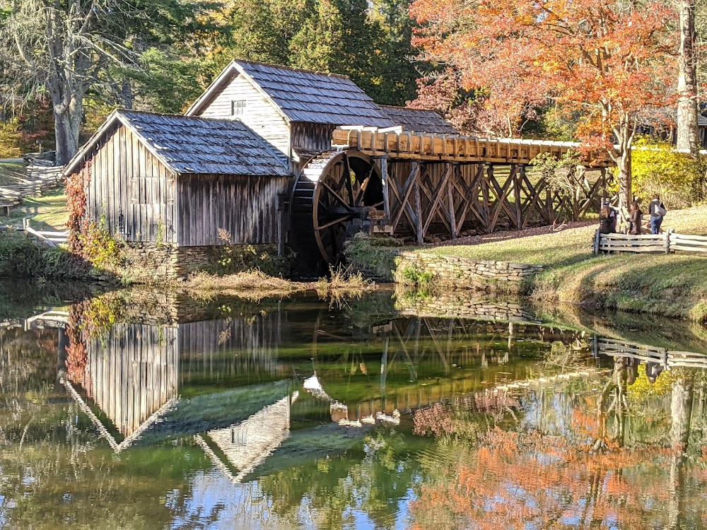
The most photographed spot on the Parkway, and a genuinely big-rig-doable scenic stop because there are zero tunnels in Virginia. Mabry Mill (MP 176) has a large day-use lot with bus/RV room, and the surrounding Rocky Knob overlooks are wide and gently graded. You can run a 40 ft+ rig through this stretch without a clearance worry — just mind the lot fills on fall weekends.
| Data point | Value |
|---|---|
| Big-rig parking | Large paved day-use lot with RV/bus room (inferred — verified RV-accessible stop) |
| Access & exit | Pull-in/loop lot; no backing required at the main lot (inferred) |
| Overnight allowed | No — day-use only (no overnight on Parkway overlooks) |
| Low-clearance warnings | None — Virginia section is tunnel-free |
| Lot surface & grade | Paved, gentle grade (inferred — mountain plateau) |
| Fuel within ~5 mi | Diesel + propane — US-58 Meadows of Dan (inferred) |
| Type | Scenic / historic mill |
| Big-Rig Score | 7.5 |
Blue Ridge Pkwy, Meadows of Dan, VA 24120 · (828) 348-3400 (verified Jun 2026)
3. Peaks of Otter Campground — MP 85.6 (Bedford, VA)

The first honest low pick, and a useful reality check on what NPS Parkway campgrounds are not. Peaks of Otter is gorgeous and tunnel-free, but it's terraced into a hillside with no hookups, the practical max for most sites is around 30 ft, and reviewers describe maneuvering as difficult "for all but the smallest of RVs." A short rig with planning can make it; a 40 ft+ big rig should base off-Parkway and day-trip the lake and lodge instead.
| Data point | Value |
|---|---|
| Max rig length | ~30 ft practical (a few longer sites exist; confirm per-site on Recreation.gov) |
| Turn radius / entry | Terraced hillside, tight switchback loops — difficult for big rigs |
| Pull-through vs. back-in | Mostly back-in, short sites |
| Low-clearance warnings | None (Virginia, tunnel-free) — the limit here is length and maneuvering, not height |
| Fuel within 10 mi | Limited on-Parkway; diesel + propane via Bedford / Route 43 (inferred) |
| Grade on approach | Steep terraced sites and switchbacks (inferred — caution) |
| Overnight allowed | Yes — NPS campground, no hookups, 14-day limit |
| Surface / power | Paved/gravelno electric/water/sewer hookupsdump station |
10454 Peaks Rd, Bedford, VA 24523 · (540) 586-7321 (verified Jun 2026)
Segment 2 — High Country NC (MP 217–340): basecamp before the tunnels
4. Grandfather Mountain Campground RV Resort — Banner Elk, NC (near MP 305)

The first strong North Carolina basecamp heading south, positioned for the Linn Cove Viaduct and Grandfather Mountain day-trips. Year-round 30 and 50-amp full-hookup sites, convenient to Boone, Blowing Rock, Banner Elk, and Beech Mountain. Site dimensions vary, so confirm a pull-through and exact length when you book if you're at 45 ft — but this is a comfortable, well-placed high-country base off the Parkway proper.
| Data point | Value |
|---|---|
| Max rig length | 40–45 ft (inferred — confirm pull-through length at booking) |
| Turn radius / entry | High-country resort; confirm site row (inferred — adequate) |
| Pull-through vs. back-in | Both (inferred — confirm) |
| Low-clearance warnings | None at park; stay off the Parkway tunnels — base here and day-trip |
| Fuel within 10 mi | Diesel + propane — Boone / NC-105 corridor (inferred) |
| Grade on approach | Mountain access; manageable via valley roads (inferred — caution) |
| Overnight allowed | Yes — open year-round |
| Surface / power | Full hookups · 30/50-amp |
125 Profile View Rd, Banner Elk, NC 28604 · (800) 788-2582 (verified Jun 2026)
5. Boone KOA Holiday — Boone, NC (near MP 291)

A reliable, big-rig-friendly base for the Boone and Blowing Rock section, with pull-through sites and 50/30-amp service. KOA's standardized layout and arrival help make it an easy "set up once, day-trip the Parkway in the toad" choice. As with all high-country parks, the access roads climb — plan the approach from the valley side and you're fine at 40 ft+.
| Data point | Value |
|---|---|
| Max rig length | 40–45 ft (inferred — KOA pull-throughs; confirm length) |
| Turn radius / entry | KOA layout with arrival assistance (inferred — adequate) |
| Pull-through vs. back-in | Pull-through and back-in (50/30-amp) |
| Low-clearance warnings | None at park; base here — do not take the rig onto the NC tunnel sections |
| Fuel within 10 mi | Diesel + propane — US-321 / US-421 Boone (inferred) |
| Grade on approach | High-country grades on access roads (inferred — caution) |
| Overnight allowed | Yes (reservation campground) |
| Surface / power | Full hookups · 50/30-amp |
123 Harmony Mountain Ln, Boone, NC 28607 · (828) 264-7250 (verified Jun 2026)
6. Linn Cove Viaduct Overlook — MP 304.4 (near Grandfather Mountain, NC)

The single most famous engineering feature on the Parkway, and drivable in a big rig because this section has no tunnels. The viaduct itself carries full Parkway traffic, and the visitor-center lot at the south end has RV/bus parking. This is the rare NC Parkway segment a 40 ft+ rig can run — but it's also the gateway to the high country, so still base nearby rather than continuing south through the tunnel zone.
| Data point | Value |
|---|---|
| Big-rig parking | Visitor-center lot with RV/bus room (inferred — RV-accessible stop) |
| Access & exit | Viaduct carries full traffic; lot is pull-in/loop (inferred) |
| Overnight allowed | No — day-use overlook |
| Low-clearance warnings | None on the viaduct itself — but tunnels begin farther south; turn around, don't continue |
| Lot surface & grade | Paved; mountain grade on the approach (inferred — caution) |
| Fuel within ~5 mi | Diesel + propane — NC-105 / Boone corridor (inferred) |
| Type | Scenic / engineering landmark |
| Big-Rig Score | 7.0 |
Linn Cove Viaduct, MP 304.4, Blue Ridge Pkwy, near Linville, NC 28646 · day-use · tunnel-free at this milepost
Segment 3 — Asheville hub (MP 340–410): the best basecamps
7. Asheville Bear Creek RV Park & Campground — Asheville, NC

The top big-rig basecamp for the whole Parkway. Over 100 paved, level sites including 25 pull-throughs at 25 ft × 60 ft and dedicated big-rig sites, full 30 and 50-amp hookups, and — critically — easy access to I-40, I-240, and I-26, so you never fight a mountain grade to get in. From here you can day-trip Craggy Gardens, the Folk Art Center, and Mount Pisgah in the toad and leave the rig level and hooked up.
| Data point | Value |
|---|---|
| Max rig length | 45 ft (60 ft pull-through pads) |
| Turn radius / entry | Paved, level; easy interstate access (I-40/I-240/I-26) |
| Pull-through vs. back-in | 25 pull-through (25×60) + 65 back-in (25×50) + big-rig sites |
| Low-clearance warnings | None at park; flat interstate approach (no Parkway tunnels involved) |
| Fuel within 10 mi | Diesel + propane — I-40 / I-26 Asheville corridor (inferred — strong) |
| Grade on approach | None — interstate access, level sites |
| Overnight allowed | Yes (reservation campground) |
| Surface / power | Paved · 30/50-amp full hookups |
81 S Bear Creek Rd, Asheville, NC 28806 · (828) 253-0798 (verified Jun 2026)
8. Craggy Gardens — MP 364.6 (near Asheville, NC)

A spectacular rhododendron-bald overlook north of Asheville — and the practical northern limit before clearance gets dicey. Craggy Knob has parking for cars and RVs, but the Craggy Gardens Visitor Center lot is pull-in for cars only, and the approach is a steep, winding climb. A shorter rig can do it with care; a 45-footer is far happier visiting from a toad. Scored as "workable with planning" precisely because the maneuvering, not a tunnel, is the limiter here.
| Data point | Value |
|---|---|
| Big-rig parking | Craggy Knob: cars + RVs. Visitor Center lot: cars only |
| Access & exit | Steep, winding mountain climb; tight at the visitor center (inferred — caution) |
| Overnight allowed | No — day-use only |
| Low-clearance warnings | No tunnel at this milepost, but tunnels lie both north and south — know your route |
| Lot surface & grade | Paved; steep grade on approach (inferred — caution) |
| Fuel within ~5 mi | Diesel + propane — Asheville / US-70 corridor (~10+ mi) (inferred) |
| Type | Scenic overlook / hiking |
| Big-Rig Score | 6.5 |
Craggy Gardens, MP 364.6, Blue Ridge Pkwy, near Asheville, NC 28804 · day-use · RV parking at Craggy Knob only
9. Mama Gertie's Hideaway Campground — Swannanoa, NC

The honest "workable with planning" basecamp east of Asheville. It has 25 pull-through sites with 30/50-amp full hookups and welcomes big rigs — but the property is built on a hillside with tight turns and a steep (now-paved) climb to the upper sites that reviewers call intimidating in a big rig. Call ahead, request a lower-tier pull-through sized for your length, and arrive in daylight. The reward is a quiet, well-run base minutes from I-40.
| Data point | Value |
|---|---|
| Max rig length | 40 ft comfortable; longer with a requested lower pull-through (inferred — caution) |
| Turn radius / entry | Tight turns, steep paved climb to upper sites — request lower tier |
| Pull-through vs. back-in | 25 pull-through + back-in (30/50-amp) |
| Low-clearance warnings | None at park; tree canopy on interior — confirm on arrival (inferred — caution) |
| Fuel within 10 mi | Diesel + propane — I-40 Swannanoa / east Asheville (inferred — strong) |
| Grade on approach | Steep interior climb (inferred — caution; arrive in daylight) |
| Overnight allowed | Yes (reservation campground) |
| Surface / power | Paved · 30/50-amp full hookups + cable |
15 Uphill Rd, Swannanoa, NC 28778 · (828) 686-4258 (verified Jun 2026)
10. Mount Pisgah Campground — MP 408.6 (near Asheville, NC)

The most usable on-Parkway NPS campground for a longer rig — with caveats. Most sites cap around 40 ft and have no hookups, though Recreation.gov lists per-site max lengths and one site rated to 80 ft. It sits at high elevation between low-tunnel sections, so the approach direction matters: come up from the Asheville/I-26 side to avoid the worst of the southern tunnels. Real "workable with planning" territory — boondock-capable rig, confirmed long site, and a careful route.
| Data point | Value |
|---|---|
| Max rig length | ~40 ft most sites; up to 80 ft on one site — confirm per-site on Recreation.gov |
| Turn radius / entry | NPS loop roads at elevation; check site length before booking |
| Pull-through vs. back-in | Mostly back-in NPS sites |
| Low-clearance warnings | Tunnels lie south of here toward Cherokee — approach from the Asheville side |
| Fuel within 10 mi | Limited on-Parkway; diesel + propane down in the Asheville/Brevard valleys (inferred — caution) |
| Grade on approach | High-elevation Parkway grades (MP 408, ~5,000 ft) (inferred — caution) |
| Overnight allowed | Yes — NPS campground, no hookups, dump station, 14-day limit |
| Surface / power | Paved/gravelno hookups |
408 Blue Ridge Pkwy #8, Canton, NC 28716 · (828) 648-2644 (verified Jun 2026)
Segment 4 — Southern end NC (MP 410–469): the tunnel turnaround
11. Waterrock Knob — MP 451.2 (near Maggie Valley, NC)

The last big scenic stop a tall rig should attempt before the lowest tunnels, and a hard turnaround point. Waterrock Knob has a large open parking area with wide spaces and privy restrooms on an exposed ridge — genuinely RV-accessible. But it sits at MP 451, and just south of here the clearance drops off a cliff (Lickstone 11'8", Bunches Bald 12'3", Big Witch 11'7"). Visit it, soak in the view, and turn around: do not continue toward Cherokee in a 12 ft+ rig.
| Data point | Value |
|---|---|
| Big-rig parking | Large open lot, wide spaces — RV-accessible (verified Jun 2026 — NPS describes wide-open parking) |
| Access & exit | Open ridge lot; easy in/out (inferred) |
| Overnight allowed | No — day-use only |
| Low-clearance warnings | CRITICAL: lowest Parkway tunnels begin within ~10 miles south — turn around here |
| Lot surface & grade | Paved; high, exposed ridge (~5,800 ft) (inferred — caution) |
| Fuel within ~5 mi | Limited; diesel + propane down in Maggie Valley / US-74 (inferred — caution) |
| Type | Scenic overlook / visitor center |
| Big-Rig Score | 6.0 |
Waterrock Knob, MP 451.2, Blue Ridge Pkwy, near Maggie Valley, NC 28751 · day-uselast safe big-rig stop before the tunnels
12. The Big Witch & Lickstone Tunnels — MP 458–461 (NC)

The honest "not recommended" entry — included so you know exactly where the Parkway stops being a big-rig road. This cluster has the lowest posted clearances on the entire Parkway: Big Witch (MP 461.2) at 11 ft 7 in, Lickstone Ridge (MP 458.8) at 11 ft 8 in, Bunches Bald (MP 459.3) at 12 ft 3 in — all at the edgeline, all subject to a further 1–6 in drop after repaving. Most Class A motorhomes (12–13 ft) will not clear these. The Park Service itself notes drivers skip the Waynesville-to-Cherokee section entirely. Park the rig at a basecamp and take this stretch in the toad, or detour via US-74/US-19.
| Data point | Value |
|---|---|
| Big-rig parking | N/A — do not bring the rig |
| Access & exit | No turnaround mid-tunnel-zone — commit to the detour before MP 451 |
| Overnight allowed | No |
| Low-clearance warnings | DISQUALIFYING: 11'7"–12'3" posted edgeline, minus 1–6 in for repaving. Class A rigs will not clear. |
| Lot surface & grade | Mountain Parkway; steep, winding |
| Fuel within ~5 mi | None on the Parkway here (inferred) |
| Type | Low-clearance tunnel cluster (avoid) |
| Big-Rig Score | 1.5 |
Big Witch / Lickstone / Bunches Bald tunnels, MP 458–461, Blue Ridge Pkwy, NCclearance 11'7"–12'3" — detour via US-74/US-19 in the rig, or day-trip in the toad
13. Yogi Bear's Jellystone Park — Cherokee, NC (near MP 469, southern terminus)

The big-rig basecamp for the southern terminus and Great Smoky Mountains National Park — reached via the valley highways (US-19/US-441), not the tunnel section. It has 20 pull-throughs and 89 full-hookup sites with 50-amp service, river access, and resort amenities. Seasonal (late March–October). This is where you base to explore Cherokee and the Smokies, then re-enter the Parkway northbound only as far as the tunnels allow.
| Data point | Value |
|---|---|
| Max rig length | 40–45 ft (inferred — 20 pull-throughs; confirm length) |
| Turn radius / entry | Valley resort, river-side; reached via US-19/US-441 (not tunnels) (inferred — adequate) |
| Pull-through vs. back-in | 20 pull-through + 89 full-hookup sites (15/20/30/50-amp) |
| Low-clearance warnings | None at park; arrive via the valley highways — never the Parkway tunnel section |
| Fuel within 10 mi | Diesel + propane — US-19 / US-441 Cherokee (inferred — strong) |
| Grade on approach | Valley access; manageable (inferred) |
| Overnight allowed | Yes — seasonal (late March–October) |
| Surface / power | Full hookups · 50/30/20/15-amp |
317 Galamore Bridge Rd, Cherokee, NC 28719 · (828) 497-6147 (verified Jun 2026)
How we scored these
Route stops are scored on the Big-Rig Standard™ using the rubric that matches each stop's type. Campground stops are weighted on length capacity (30%), site type & power (20%), maneuverability (20%), clearance & grade (15%), fuel & services within 10 mi (10%), and stay flexibility (5%). Scenic and fuel stops are scored on big-rig parking capacity, access and exit without backing, overnight rules, lot surface and grade, low clearance, and nearby fuel.
On this corridor, clearance and grade carry unusual weight because they're the actual reason a big rig can't drive the whole route. Tunnel clearances are quoted from the National Park Service (nps.gov/blri) as posted edgeline minimums; we treat them as conservative ceilings because the Park Service warns they can drop 1–6 inches after repaving. Campground site dimensions, amp service, pull-through availability, and surface are sourced from park listings (June 2026). Fuel proximity and approach grade are inferred from terrain and the road network and marked (inferred). Where a stop's whole value rests on a safety field, we flag rather than reassure — an unmarked clearance on this page is never an "all clear."
How this list was made: We mapped the Parkway milepost-by-milepost, pulled the official NPS tunnel-clearance table, identified the tunnel-free Virginia section and the low-clearance NC cluster, then selected big-rig basecamps off the Parkway (reachable via interstate/valley highways) and the scenic stops with verified RV parking. Each stop was scored on the Big-Rig Standard™ rubric for its type, ranked within its segment, and cross-checked against guest reviews on Campendium, RV LIFE, and Good Sam. Research and drafting were AI-assisted and human-reviewed. We have not personally driven every tunnel or staged every rig — where a score rests on inference rather than a published spec, the cell is marked (inferred), and clearance/grade fields are kept conservative. No business paid for placement or for its score.
Sources
- Tunnel clearances and campground length notes: National Park Service, Blue Ridge Parkway — Tunnel Heights, Mount Pisgah Campground, Peaks of Otter Campground (nps.gov/blri, accessed June 2026).
- "RV the Parkway" tunnel/grade guidance and the Waynesville–Cherokee caution: blueridgeparkway.org (accessed June 2026).
- Campground specifications: official listings for Fancy Gap / Blue Ridge Parkway KOA, Grandfather Mountain Campground RV Resort, Boone KOA Holiday, Asheville Bear Creek RV Park, Mama Gertie's Hideaway, and Yogi Bear's Jellystone Park Cherokee (accessed June 2026).
- Overlook RV-accessibility (Mabry Mill, Linn Cove Viaduct, Craggy Gardens, Waterrock Knob): NPS Plan Your Visit pages and Parkway overlook guides (accessed June 2026).
- Maneuvering / grade notes: guest reviews on Campendium, RV LIFE, and Good Sam (accessed June 2026).
Verification status (last verified June 11, 2026): Tunnel clearances (Big Witch 11'7", Lickstone 11'8", Bunches Bald 12'3") confirmed against the NPS tunnel-heights table. Name, address, and phone confirmed for Asheville Bear Creek, Grandfather Mountain Campground, Mama Gertie's, and Yogi Bear's Jellystone Cherokee; phone and street address deferred to merge fields (,) for Fancy Gap KOA pending direct confirmation; phone deferred to for Boone KOA pending direct confirmation. NPS campground length limits (Mount Pisgah, Peaks of Otter) confirmed as varying per-site via Recreation.gov. Fuel along the interstate/valley corridors is high-confidence but marked (inferred) where not individually walked. Per-listing GPS coordinates and Street-View clearance checks at each tunnel are deferred to the directory build / a connected browser — given the safety stakes, every driver should re-confirm their rig's exact height against the posted clearance before entering any NC tunnel.
Frequently asked questions
Can you drive a big rig on the Blue Ridge Parkway?
Only partially. Virginia's 217 tunnel-free miles (MP 0–217) are drivable in a 40 ft+ rig, but the North Carolina section has 25 tunnels — the lowest, Big Witch at MP 461.2, is just 11 ft 7 in at the edgeline, which most Class A motorhomes (12–13 ft tall) cannot clear. The practical plan is to basecamp off the Parkway near Asheville, Boone, or Cherokee and day-trip the scenic NC sections in your towed vehicle.
Which Blue Ridge Parkway tunnels should a big rig avoid?
The lowest are clustered at the southern NC end: Big Witch (MP 461.2, 11 ft 7 in), Lickstone Ridge (MP 458.8, 11 ft 8 in), and Bunches Bald (MP 459.3, 12 ft 3 in) — all posted edgeline clearances that can drop another 1–6 inches after repaving. The entire Waynesville-to-Cherokee stretch is the section RVers most often skip. Turn around by Waterrock Knob (MP 451) and detour via US-74/US-19.
Where should a big rig basecamp to see the Blue Ridge Parkway?
Three hubs, by region: Asheville Bear Creek RV Park (9.0) off I-40/I-26 for the central Parkway and Pisgah area; Boone KOA or Grandfather Mountain Campground (8.0) for the high country and Linn Cove Viaduct; and Yogi Bear's Jellystone Cherokee (7.5) for the southern terminus and the Smokies. All are reached via interstate or valley highways, so you never take the big rig through a tunnel.
Are there big-rig campgrounds directly on the Blue Ridge Parkway?
The Parkway's own NPS campgrounds (Mount Pisgah MP 408, Peaks of Otter MP 86, and others) have no hookups and per-site length limits — most cap around 30–40 ft, with rare longer sites at Mount Pisgah. They're workable only for a boondock-capable rig with a confirmed long site. For 50-amp full hookups, use the off-Parkway basecamps above and day-trip in.
Is the Virginia section of the Blue Ridge Parkway big-rig friendly?
Relatively, yes. All but one of the Parkway's 26 tunnels are in North Carolina, so the 217-mile Virginia section (MP 0–217) is the one stretch you can run a tall rig with confidence on clearance. Length and maneuvering still matter at the overlooks and NPS campgrounds, but the height worry that defines the NC end is largely off the table in Virginia.
How long does it take to drive the full length of the Blue Ridge Parkway?
Plan on more than a single day. The Parkway runs 469 miles at a 45 mph speed limit, and with overlooks your real pace is closer to 30 mph, so most visitors take three to five days end to end. For a big rig the honest answer is longer still: you won't drive the whole thing in the rig at all — you'll basecamp off the Parkway and day-trip the scenic NC sections in your toad.
Where is the best place to start driving the Blue Ridge Parkway?
North-to-south, starting at the Virginia (MP 0) end near Waynesboro, is the smart sequence for a tall rig. You get Virginia's 217 tunnel-free miles first, then transition to a fixed basecamp before the North Carolina tunnels begin. If your trip is anchored on Asheville, start there and run the central section in both directions from an Asheville basecamp instead.
What is the prettiest section of the Blue Ridge Parkway?
Two stretches consistently top the lists: the high country around the Linn Cove Viaduct (MP 304) and the Asheville-to-Mount Pisgah run (MP 384–408). Both are drivable in a tall rig because they're tunnel-free at those mileposts. On this page they score Linn Cove Viaduct 7.0 and the Pisgah-area stops in the 5.0–6.5 band, with the Asheville basecamps making them easy day-trips.
What is the steepest grade on the Blue Ridge Parkway?
The Park Service doesn't publish one single "steepest grade" figure for the corridor, and we don't invent one. What matters for a big rig is that the whole route is a mountain road with sustained climbs and descents, and several campground and overlook approaches are steep enough that we flag grade conservatively on this page. Treat every approach as a real grade and gear down rather than ride the brakes.
Are there bears in the Blue Ridge Parkway?
Yes. The corridor has a healthy population of American black bears, so standard bear-country rules apply: keep your distance (the Park Service recommends well over 100 feet), never feed or approach them, and store food and trash secured — especially at the NPS campgrounds. Bears are a camp-discipline issue, not a driving one, but they're real along the whole Parkway.
How many people died on the Blue Ridge Parkway?
The Parkway is one of the busier National Park units for fatalities, with vehicle accidents the leading cause — it is a long mountain road with steep grades, tight curves, and weather. We don't publish a precise annual body count we can't verify, but the takeaway for a big-rig driver is the safety one this whole page is built on: respect the grades, the curves, and the tunnel clearances, and don't put a tall, heavy rig somewhere it doesn't fit.
Is the Blue Ridge Parkway open between Asheville and Cherokee, NC?
That southern segment is the one most affected by seasonal and weather closures, and it's also the low-tunnel zone a tall rig shouldn't drive anyway. Always check the NPS real-time closure map before you go (nps.gov/blri). For a big rig, the plan doesn't change either way: basecamp near Asheville or Cherokee and reach the southern end via the valley highways, not the tunnel section.
Why are they closing the Blue Ridge Parkway?
Closures are almost always weather, repairs, or seasonal conditions — ice, fog, rockslides, storm damage, and maintenance — not a permanent shutdown. Sections close and reopen throughout the year, so any given milepost can be open one week and closed the next. Check the NPS closure map for the segment you want before planning around it.
Compare across the directory: Big-Rig Friendly Campgrounds in North Carolina · Big-Rig Friendly Restaurants in North Carolina (with RV parking) · Big-Rig Friendly Stops Along I-40 (the interstate that flanks the Parkway) · What "Big-Rig Friendly" means
[ Submit a correction → ] Driven the Parkway in a big rig? Tell us which clearance, grade, or site detail we got wrong and we'll update the score.
Found a stop we missed — or got wrong?
The standard gets sharper when real RVers push back. Tell us what you saw on the ground and we'll re-check it.